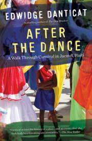
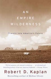
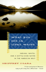
What You See in Clear Water

Indians, Whites, and a Battle Over Water in the American West

Look inside
For nearly a century, the Indians on the Wind River Reservation in Wyoming have been battling their white farmer neighbors over the rights to the Wind River. What You See in Clear Water tells the story of this epic struggle, shedding light on the ongoing conflict over water rights in the American West, one of the most divisive and essential issues in America today.

While lawyers argued this landmark case all the way to the U.S. Supreme Court, Geoffrey O’Gara walked the banks of the river with the farmers, ranchers, biologists, and tribal elders who knew it intimately. Reading his account, we come to know the impoverished Shoshone and Arapaho tribes living on the Wind River Reservation, who believe that by treaty they control the water within the reservation. We also meet the farmers who have struggled for decades to scratch a living from the arid soil, and who want to divert the river water to irrigate their lands. O’Gara’s empathetic portrayal of life in the West today, the historical texture he brings to the land and its inhabitants, and the common humanity he finds between hostile neighbors on opposite sides of the river make What You See in Clear Water an unusually rich and rewarding book.

“A clear-eyed portrait of Westerners trying to pull a living from a difficult land” -- Outside

“A rare blend of fact and emotion that will inform and move readers.” —Dallas Morning News

“O’Gara is a lyrical writer when sketching pictures of the land. He is fair and evenhanded . . . [and] lets his characters have their say.” —The New York Times Book Review

“A terrific book by a writer patient and sympathetic enough to air all the complex issues, the triumphs and failures, without judging anybody” -- William Kittredge, author of Hole in the Sky
from CHAPTER 1
Wind River Canyon

A century ago, when a journey from the Union Pacific depot in Rawlins, Wyoming, to the Shoshone Indian Reservation meant 150 miles in a hard saddle across windy tablelands set with waist-high sagebrush, Indian Inspector James McLaughlin trekked to Wind River Canyon. On the long trip north, he rarely looked up at the tall skidding clouds, or down at the sudden draws that dropped through the floor of the plains. It was spring, but barely spring, and scalloped ridges of snow still snugged against the lee sides of the hills. The creeks were mostly still dry, deep cracks blistering across the dun-colored plain. The ground was as cold as a corpse, but in places where the sun could soften it, gnarls of dust rose behind the horses. Then the clouds would collide in the huge sky, and the whitened bone of parched land would be suddenly drenched. Bentonite in the soil would turn it to a paste that coated the wheels until they looked like gray balloons, so heavy and slippery that the horses couldn't pull. McLaughlin would wait it out patiently. He was a twenty-five-year veteran of the Indian Service, and he'd made trips like this before into harsh corners of the plains that had been left to the Indians. The government recognized his knack for parleying with tribes, and it sent him all over the West. With experience and the trust he felt he'd earned among the Indians, he found these negotiations were not difficult; it was getting there that was hard.
The high desert McLaughlin crossed was the bottom of an evaporated ocean that once thinly covered the belly of the continent. Uplifted and emptied, the ocean bottom was turned back like a sheet and smoothed by wind. Along McLaughlin's route were hogbacks of red sandstone and scatterings of jade on the ground, but only an avid rockhound would want to linger. Now and then spikes of granite poked through, including a pinkish hump like Split Rock, a landmark westward immigrants still looked for in McLaughlin's time. West of the Rawlins uplift, the creeks drained into a desert bowl with no outlet--the Great Divide Basin, where the Continental Divide forks into west and east branches.

At night, if the wind wasn't whistling, the coyotes howled; now and then, as the party headed north, they found a fire ring and grass munched down by pack animals. But there were more signs of death than life: the curled ribs of an antelope carcass, a collapsed homestead cabin with a fallen wooden cross over a child's grave. An experienced traveler accepted the monotony, hardened himself to the artifacts of past suffering, and prepared for the unfriendliest weather. McLaughlin kept his gaze low and forward. This kind of open vista, this nakedness, had driven people mad.
Several days into the trip, the plateau suddenly dropped away. They couldn't see the escarpment as they approached it, because the world had been flat for miles, but by then they had spotted the white peaks of the mountains rising above the long curve of horizon and knew the ordeal would end soon. They dropped off Beaver Rim and the world began to change.

The desolate prelude made the natural beauty of the Wind River all the more stirring. The valley is a small concavity of warm, still air and braided river bottom that would seem to have no place in the midst of the high desert. The plains form a huge moat to the east and south--much more intimidating distances in McLaughlin's time than now--and on the other two sides rise knifelike peaks that only a fool, or an explorer like John Frémont, would scale. The basin was not without its own scabby draws and sagebrush snags, but the natural ramparts provided a sense of security missing on the trip north. The travelers were relieved, though no one said so. Thickly forested lake-dotted foothills sloped up to the west, and a weave of rippling water lined by cottonwoods etched the broad valley below.

McLaughlin had been the agent at Standing Rock in the Dakotas, a much bleaker post, where the Sioux leader Sitting Bull had been killed during McLaughlin's tenure. Wind River, with its generous portions of lakes and timber and arable land, was unusually rich in resources for a reservation. He looked into the steep cut where the Wind River plunged through the Owl Creek Mountains and was particularly impressed. "It is really such a grand work of nature that I believe, when the transportation problem has been solved in that country, it will rival the Yellowstone Park and the Grand Canon [sic] of the Colorado as an attraction for lovers of scenic grandeur."
McLaughlin's mission to Wind River in 1896 did not directly concern the canyon, but an area just downstream. He was meeting with leaders of the Northern Arapaho and Eastern Shoshone tribes to discuss an enormous hot spring that flowed from a red sandstone outcrop over a white travertine shelf into the Bighorn River just north of the canyon. McLaughlin, who had been called "White Hair" by the Sioux during his years in South Dakota, came to negotiate the sale of the hot spring. Among the largest in the world, it poured out nearly 19 million gallons of scalding water daily, and frontier entrepreneurs were diverting it in crude ditches to tent-walled spas with names like the Hotel de Sagebrush. They had visions of a Saratoga-like health resort. First, though, there was
the problem of land title: the spring and the surrounding lands belonged to the tribes.

McLaughlin considered himself sympathetic to Indians--his wife was part Santee Sioux--but he shared the prevalent view that white dominance of Indians was "natural law." His role in dismantling the Sioux reservation had made him no allies among Sitting Bull's followers, but he titled his memoirs My Friend, the Indian, and in them he sounded sympathetic indeed. "The Indian," he wrote, "has been made the object of speculative persecution by every white man who felt that he needed what the Indian possessed." Perhaps he touted the beauty and tourism potential of the canyon--which would remain in Indian hands--to distract attention from his role in relieving the tribes of the hot springs. The springs never became a western Saratoga, but today they are piped through commercial pools and resort motels in a state park.

Nowadays you will rarely see an Indian face at the hot springs, but once a year Native Americans turn out in force, and in costume, for a pageant called the Gift of the Waters. While local farm girls in moccasins and greasepaint sing praises to the hot spring, the legendary Shoshone chief Washakie raises his arms in welcome to the tourists and reads from a script: "I Washakie freely give to the Great White Father these waters beloved of my people that all may receive the great blessing of bodily health in the bathing. Red man or white, the difference lies only in outward appearance, our father knoweth his children by their hearts, and knowing them, loves them. . . . May we meet with no line a boundary, save that of mountains majestic and rivers of pure flowing water, receiving a kind benediction of love from the One Dama Upa."

The old chief is played by Starr Weed, a white-haired Shoshone dressed in a feathered headdress and buckskin decorated with colorful beading and quillwork; he smiles fixedly at the camera-wielding tourists, who are dressed in Ray-Bans and Bulls T-shirts and sun block. The script is, well, pageantlike, and Weed recites his lines stiffly but affably, stumbling now and then in the purple rhetoric, squinting at the paper before him. The crowd doesn't seem to mind, or pay much attention to what Weed says: they've come more for the dancing and costume. When it's over, they turn away and head for the pool or the camper, talking about which resort has the better water slides or where they'll rendezvous for dinner.
Weed had some pageant cash in his pocket and a smile on his face when we shook hands beside the hot spring. "The Shoshone came here on a hunt, from way over on the other side," he said with a gesture west, "and they saw something up there." He pointed to a ledge of tan sandstone that forms a bed-sized platform in the rock above the green-bottomed pool where the water emerges. Weed speaks slowly and gestures with his hands, smiling always. The hot springs in this basin were homes to monstrous serpents, and the Shoshone were warned by the Nimimbe--an elusive race of dwarfish mountain people--to respect them or suffer consequences. This is not mentioned in the pageant script, but an elder like Weed knows all about it. "That's where the lizard was, bigger than a man, and when the people came, he rolled off the ledge and plunged down into the spring. Scared them bad. The old people tell me that."

Weed is a descendant of Chief Washakie, the warrior who according to some stories cut the heart out of a Crow chief in a fight over which tribe would control the hunting grounds of the Wind River Valley. Weed was a latter-day warrior himself, spending months in a German prison camp during World War II; he has served on the Shoshone ruling council, and is a rancher who trains horses and riders for bareback races at Indian rodeos. He could have told the hot springs story more easily, and surely differently, in Shoshone or sign language.


Nearly a century after McLaughlin admired the canyon upstream from the hot springs, few tourists find their way to the steep gorge where the Wind River drops through the Owl Creeks. They pass through on a highway cut into the cliffs along the river, usually on their way to Yellowstone National Park. That trip is often broken up by a stop in Thermopolis, where the hot spring is now harnessed for water slides and spas, owned by non-Indians. At the top of the canyon is a dam built by the U.S. Bureau of Reclamation, so the flows through the canyon fluctuate less than they did in McLaughlin's time. Fishermen may have heard that there are big trout in the canyon's pools--big, but hard to catch--and some stop to cast a line, though others find it too much trouble to buy a reservation fishing license on top of their Wyoming permits. Kayakers often ask if they can run the canyon's rapids, but are refused by the tribes (a few have run them anyway). At the bottom of the canyon, where the walls drop away and the river smooths out, is a site called Wedding of the Waters, where the Wind River becomes the Bighorn River, for reasons no one can remember.

Recently, though, Darren Calhoun has begun taking adventurous visitors on whitewater raft trips down the canyon. In an eddy near the top of the canyon, not far below Boysen Reservoir, he stands thigh-deep in the water and steadies a rubber raft loaded with me and a group from Iowa. Heavyset and long-haired, Calhoun is an Eastern Shoshone whose ancestors were present at the McLaughlin negotiations. He and his college roommate spent a few fun years in Jackson Hole after graduation, and at one point he took his father, Pete Calhoun, on a raft trip down the Snake River. Calhoun fils and père decided to approach the tribes about setting up an Indian-run business in the canyon. Calhoun spends most of the year in graduate school in Montana, while Pete ranches on the upper reaches of the Wind River--and some of the water passing through the canyon today might first have crossed his fields, a hundred miles away.
In June, the river is swollen with snowmelt from the mountains in the west, raising some of the rapids close to a difficult, Class V rating. Calhoun asks the passengers in the raft if any have whitewater experience. Where the river is not whipped into foam, it is pale brown, partly from eroding sandstone far upstream and partly from irrigation runoff that carries soil from the fields into the river. Patches of moss, torn from hot springs rising in the streambed, float in the water. The river has good-sized trout, but they're invisible this time of year.

Darren normally has a dry sense of humor--as he backs his trailer full of rafts toward the river, he cackles a little at his own erratic steering and mutters "back-paddle!"--but not once he's in the water. He was affected deeply when a rafter died after a boat overturned earlier in the summer, though the cause of death was a heart attack, not a boatman's mistake. He went to a traditional Shoshone sweat afterward, and as the cedar fumes and steam filled the lodge he felt a panicky impulse to flee, imagining in the darkness that everyone was looking at him, the way tearful people looked up at him on the riverbank after the man didn't respond to CPR.

Growing up on his father's ranch along the Upper Wind, Darren rode horses from boyhood. These were not trail-plodding plugs but working horses, smart and agile. A boy sitting atop a powerful animal would not be there long if he was inattentive or cruel. Now, pushing off from the riverbank, he encouraged his guests in the canyon to approach the river the way he had a horse--with respect. "You can't just yahoo down this river," he said, "when the water is this high"--more than 4,000 cubic feet per second, pushing up standing waves taller than a man. With an edge in his voice to keep their attention, he explained how to pull a passenger back on board if someone took an unscheduled "swim." He was much more earnest than any stewardess as he gave the rafting equivalent of make-sure-your-seat-belts-are-securely-fastened. But as he listened to the unconcerned giggles from the front of the boat, he wondered if his clients these days came from a world so conditioned by the artificial thrills of amusement parks that a truly wild river was inconceivable.

To date, no amusement park has been able to create this sort of geological sculpture: a steep-walled incision into dark metamorphic rock laced by veins of pink and white quartz, with towering sandstone walls looming hundreds of feet above. Below, tapering down to the river, gentler talus slopes are anchored by grasses and juniper. A sparse fringe of conifers spikes the canyon rim, atop a vertical wall where only bighorn sheep can find footing. The stratigraphy of rock visible in the walls of the canyon is not horizontal but tilts downward south to north more steeply than the grade of the canyon itself, creating a dizzying sensation of going up when you travel down the canyon, and vice versa. In the wall are dips and shadows like the features of a face, where boulders have broken loose and tumbled down to the river. Some of those rocks, as big as small houses, now clog the riverbed and force the water to take odd twists and turns.

The jumble of colors and formations is typical of Rocky Mountain geology, where thrusting and faulting tilt the strata laid down in ancient seas and ridges. It's not unusual for pre-Cambrian rock to be found folded over Flathead sandstone two billion years younger, or to find ocean-bed fossils on a peak of igneous basalt.

The mountains the canyon cuts through are actually an older range than the towering peaks along the Continental Divide to the west. The Owl Creeks were buried beneath a huge load of sediments that eroded rapidly from the younger and taller Rocky Mountain ranges that thrust up 100 million years ago. For millions of years they lay in a tomb of silt. Then the region as a whole lifted again, and the streams pouring off the Rockies got faster, cut deeper. Eventually, the Wind River resurrected the Owl Creeks, and cut its own difficult route north through this canyon.


The group now pushing off from the banks near the top of the canyon knows little of this, and they get only snippets of more recent history from their hosts. Indian bands--Crow, Sioux, Arapaho, Shoshone--used to cross the Owl Creeks in both directions on hunting expeditions, and many of the toughest rapids in the canyon have been named after leaders of the tribes that eventually settled here. " 'Black Coal,' " says one rafter, looking at the black shale boulders that squeeze the river channel ahead of the raft. "Is that really coal?" No, Calhoun explains, Black Coal was an Arapaho chief. "Cool," says the passenger, and then he thinks of the name of another rapid further down the river. "What about 'Sphincter'?" But today Calhoun isn't amused, even though he named that nerve-racking rapid himself.

"We're not selling culture," Calhoun told me along the river. But the names attached to the landmarks in the canyon figure large in the history of the two tribes who live on this reservation, the Northern Arapaho and Eastern Shoshone. Though you rarely see an Indian in the canyon today, there was a time when hunting parties regularly traveled back and forth from one basin to another. The vision of Yellow Hand, who brought the Sun Dance to the Shoshone, might have occurred here, according to tribal members.

The Black Coal rapid is a good paddling warm-up, a fifty-yard stretch of fast, narrow water that gives all the passengers a chance to try their strokes and feel how the raft takes standing waves. Black Coal, one of the last recognized chiefs of the Arapaho, over a century ago, is a distant relation of Calhoun's mother's family. Black Coal was a handsome man, with a broad face and a wide, expressive mouth. As a young warrior, he rolled in the ashes at a battle site where the Arapaho had fought the Utes, and earned his name. Before they were officially residents of the Wind River Indian Reservation, his people often allied themselves with the Sioux, and shared some of their claim to Black Hills territory. The tribe also had relatives in Colorado, the Southern Arapaho, and hunted now and then around the Owl Creeks. Before they settled here, they frequently were accused, along with the Sioux, of stealing from and even murdering white ranchers and miners in the Wind River country. Their historic role in some of the attacks on whites is debatable, but no one denies that they sometimes raided the settlements of an enemy tribe that lived in the area--the Shoshone.

In the 1870s, the Arapaho were still wandering, running out of places to go, pinched by encroaching white settlement, conflicts with other tribes competing for dwindling game, and the U.S. Army's increasingly firm hand against independent tribes. In 1863 and 1868, the Shoshone had signed treaties accepting the Wind River country as a reservation. The Northern Arapaho had signed a treaty in 1851 and had been promised a reservation too, but proposed sites along the North Platte and Sweetwater Rivers had never materialized.

On the morning of the Fourth of July in 1874, Black Coal's band was camped in the steep-gulleyed hills east of Wind River Canyon, along Nowood Creek. They were no sentries to spot the soldiers who were moving through the ghostly hills under cover of night. The soldiers dismounted back from the rim and approached on foot, looking down into a deep gulley. In the first glimmer of morning light, two hundred tepees cast sharp shadows alongside the small creek, with the fires smoldering, the dogs sleeping, and the horses clustered around a nearby spring. Revenge was in the hearts of some of the soldiers: Two white women living near the army post had been recently killed and mutilated by Indians, and such depredations were generally assigned to the Sioux or Arapaho. The troops advanced down the hills, and the Shoshone who were with them sang out their war cries, precipitating disorder in the ranks. The camp dogs barked. Bullets ripped the tepee hides, and the flaps of the lodges flew open. Children crawled toward the bush and men rushed out with Spencer carbines. Black Coal mounted his horse, but it was shot out from under him; he was wounded in the chest. The gulch filled with smoke, gunfire cracked all around; an elder sang his death song. A doctor accompanying the soldiers saw an Arapaho boy, shot in the leg, pull himself into a sitting position, fold his arms, and stoically face the oncoming soldiers, who finished him. In the confusion, Black Coal and several warriors made their way to the top of a sandstone butte north of the camp, and from there they fired back at their attackers, who chased off the horses and then retreated. One contemporary account described the battle as lasting minutes; another said four hours. The stories told by Arapaho elders describe the battle as a victory, and indeed, the army and the Shoshone had to retreat once the Arapaho began firing from the butte. But the Shoshone chief Washakie had called the retreat, standing below the butte with his white hair free in the wind, shouting, "Don't kill 'em any more! We have whipped them! We've set them a-foot! Don't kill 'em anymore!" At least twenty-five Arapaho were dead, their horses were gone, and other tribes would later refer to 1874 as "The Year They Killed the Arapaho." An Arapaho woman who was a child during the battle told her grandchildren that afterward, when she went to shear sheep in the Owl Creeks, she could still hear the cries of her people as they ran.


There is a long, smooth stretch of river before the next rapid, Sharp Nose, one of the toughest in the canyon. There are some big holes. When the water is low, a rock appears on the right side shaped like the probiscus of a giant floating on his back. When the water is high, rafters must stay in the middle and paddle hard.

Following the ambush in the Owl Creeks, the Arapaho tried to win friends among the whites by scouting and fighting for the army against other rebellious tribes. Sharp Nose, a younger leader, helped Black Coal in the endless negotiations with the U.S. government--at one point they met with President Rutherford B. Hayes in Washington--and when Black Coal died in 1893, Sharp Nose became head chief. The qualifications and the role of a chief had changed significantly by the time the Indian Wars drew to a close at the Wounded Knee massacre in 1890. Many of the tribal leaders of the early twentieth century were elevated more for their ability to deal with white men than for their military prowess or leadership within the tribe. They were secular, not spiritual, leaders, a distinction among elders that remains significant today. Sharp Nose was exceptional, qualifying as a chief in both the old and new sense: he was a courageous and resourceful fighter, and his recorded speeches are eloquent, and moving to whites who heard them. An army officer who served with Sharp Nose in later campaigns against Sioux and Cheyenne bands under Crazy Horse and Dull Knife described him as "dignified and commanding, coming nearer to the Fenimore Cooper style of Indian than any I have seen since my visit to [Cochise]." What good, though, was nobility during a period of enormous decline and loss? The tribes were sinking into poverty, and disease was taking many more lives than carbines; whites were chipping away at the reservations from the moment their boundaries were surveyed. The first treaty signed by the Shoshone, in 1863, described vaguely a reservation extending far into Utah, comprising as much as 44 million acres. An 1868 revision reduced the Shoshone land, and there were more cuts to come.

The Wind River Valley was the Shoshone Reservation (it would later be renamed Wind River), and the Shoshone did their best to make their traditional enemies, the Arapaho, feel like second-class citizens. The hot spring downstream from the canyon--where rafters these days usually go after whitewater trips, to relax the stress out of their bodies--was part of the original reservation. Once the white settlers began dreaming of a spa resort, McLaughlin embarked on his mission, offering $50,000 for the spring and 64,000 acres surrounding it.

It was an opportune moment in history to take advantage of the Indians. An 1894 special report to the U.S. Census indicated that while the Shoshone and Arapaho had made a good-faith effort to become farmers, they were starving, and the government had failed to deliver the food, the seed, or the tools it had promised.

The feds would offer fencing materials to get the Indians to enclose their fields and livestock. Then, after the backbreaking posthole digging was done, no wire would be provided, and hundreds of acres were "fenced by posts alone." The annuities tribal members received under the Shoshone's 1868 treaty were due to expire in two years, in 1898. The venerable Washakie, now eighty-eight years old, wanted money fast; the Shoshone lived mostly on the west side of the reservation, and Washakie considered the area around the hot springs--on the east side--worthless now that the bison had been exterminated. He resented the presence of the Arapaho at the negotiations, and for that matter their presence on the reservation at all.

When Sharp Nose took his turn to speak, he disagreed with Washakie, asking that the tribes not be given money; rations and cattle would be more useful, he said, and less likely to be squandered. Then Sharp Nose digressed, and his peculiar speech seemed to come right from his despairing heart. He had spent a lifetime serving his people, leading bison hunts, fighting for his tribe and later the U.S. Army, and now he was negotiating with the Arapaho's conquerors. But he rose in the smoky room and declared he had never done any "work," and didn't know how--a criticism of Indians that is echoed in coffee shops around the West today. "I think I am too old myself to learn how to work," he said. "When I was young, I hunted the buffalo and I was a soldier for the Great Father. Our women did the 'work' such as we had. Now our young men will learn to work, as the Great Father wishes us to do. I do not know whether the money that the Great Father will give us for the spring is enough. When I heard of it, I tried to count it but I could not do it." McLaughlin, the Indian agent and friend, raised the ante to $60,000--still a steal, the non-Indians knew.


In the middle of the canyon there is a long stretch of flat water, some of it fast and smooth, rising in humps only during high water. This section is called Sacajawea Straits, after the Shoshone "bird woman" who guided the Lewis and Clark expedition through the West, carrying her newborn child on her back.

Near the bottom of the canyon, when floaters can look ahead and see the steep walls open out into green fields and red sandstone, comes the biggest rapid of all. Calhoun barks commands, but he avoids the nervous glances from the bow of the raft--his eyes are on the water ahead. It's late in the day now, and some close calls in earlier rapids have earned the paddlers' respect. There is no easy way over Washakie Falls, which drop abruptly at least five feet across the entire river. The key is to get over without dipping the bow or turning sideways, because you meet a series of tall standing waves that will swamp you if they aren't met head on. To the right is a deadly hole, and two enormous rocks on the left. "You ready?" Calhoun asks. He should smile in reassurance, but he doesn't. "Paddle ahead!" His passengers dig for their lives as they plunge over the falls.

In October 1874, before the tribes gave up the hot spring, Chief Washakie led his people over the Owl Creeks for a fall hunt in the Bighorn Basin. Washakie, then in his seventies, was already the stuff of legend. He was tall among his tribesmen, easy with command, and graced with a sense of humor. He had scouted and fought with the U.S. Army against the rebellious Sioux, and negotiated for the Shoshone perhaps the finest reservation in the West. The tribe was "rich": there were bison herds and elk and fish abundant on their land, gold in the mountains and seeps of oil that hinted at greater wealth underground. But the scope of Shoshone life had been diminished--once they ranged as far north as Canada and south to Mexico--and as they made the adjustment to reservation life, the people became more subdued. The fall hunt was a return to the old ways, an escape from schools, farming, and a domestic life in which the warrior class no longer held much sway. Nearly two thousand Shoshone went with Washakie over the Owl Creeks in the fall of 1874, struggling through early snow to achieve the crest of the range, where the cloud cover below spread across the valley like "a wonderful ocean of pure milk." An Episcopal schoolteacher who had accompanied the hunt to provide a "roaming school" (and keep his own paycheck coming) was astonished by the singing and drumming and wild joy in their mountain camp. Young boys grabbed flaming sticks from the bonfires and ran at one another in mock combat. In a cacophony of drums and rattles, the old men sang songs of hunting and war, and medicine men prayed for success. An ecstatic Washakie strode through the camp "like another being," his white hair streaming behind him and his voice exhorting strong and clear. The teacher stayed long enough to note the Shoshones' speed and skill bringing down bison, then, realizing no one was interested in his lessons, rode back to the government school.

Just over the crest of the Owl Creeks, he happened on a small herd of buffalo that were rolling in the dust to rid themselves of vermin. To find any bison this close to the reservation settlements was increasingly rare. All over the Great Plains, they were being pushed toward extinction by hide hunters, who were killing over a million animals every year in the early 1870s. Watching the plumes of dust rise from the wallow, Patten felt a premonitory chill: The great beasts would be gone, as early as next year, and Washakie would probably never again lead a fall hunt.

Indeed, as the game diminished, Washakie lost interest in the Owl Creeks, and the Bighorn Basin to the north, and the huge hot springs that poured into the river. When he made the deal with McLaughlin twenty years later, he said he had become "afraid to stay there when there was nothing to eat." His only condition was that the springs remain free to all--a wish the state of Wyoming honors still in a small public facility sandwiched by two commercial pools. Today, a handful of tribal members still go into the Owl Creeks to fast and pray. Participants in the Sun Dance, a spiritual rite practiced by both Arapaho and Shoshone, gather sweet sage in the canyon. But this is the eastern corner of the reservation, far from the Indian communities off to the west.

Below the last rapid, the river smooths and slows, and paddlers drop backward off the raft to float on their backs in calm water--blithely unaware, or forgetful, of whose place this really is.
A journalist and the author of A Long Road Home: Journeys through America's Present in Search of America's Past, Geoffrey O'Gara lives in Lander, Wyoming. View titles by Geoffrey O'Gara

About

For nearly a century, the Indians on the Wind River Reservation in Wyoming have been battling their white farmer neighbors over the rights to the Wind River. What You See in Clear Water tells the story of this epic struggle, shedding light on the ongoing conflict over water rights in the American West, one of the most divisive and essential issues in America today.

While lawyers argued this landmark case all the way to the U.S. Supreme Court, Geoffrey O’Gara walked the banks of the river with the farmers, ranchers, biologists, and tribal elders who knew it intimately. Reading his account, we come to know the impoverished Shoshone and Arapaho tribes living on the Wind River Reservation, who believe that by treaty they control the water within the reservation. We also meet the farmers who have struggled for decades to scratch a living from the arid soil, and who want to divert the river water to irrigate their lands. O’Gara’s empathetic portrayal of life in the West today, the historical texture he brings to the land and its inhabitants, and the common humanity he finds between hostile neighbors on opposite sides of the river make What You See in Clear Water an unusually rich and rewarding book.

“A clear-eyed portrait of Westerners trying to pull a living from a difficult land” -- Outside

“A rare blend of fact and emotion that will inform and move readers.” —Dallas Morning News

“O’Gara is a lyrical writer when sketching pictures of the land. He is fair and evenhanded . . . [and] lets his characters have their say.” —The New York Times Book Review

“A terrific book by a writer patient and sympathetic enough to air all the complex issues, the triumphs and failures, without judging anybody” -- William Kittredge, author of Hole in the Sky

Excerpt

from CHAPTER 1
Wind River Canyon

A century ago, when a journey from the Union Pacific depot in Rawlins, Wyoming, to the Shoshone Indian Reservation meant 150 miles in a hard saddle across windy tablelands set with waist-high sagebrush, Indian Inspector James McLaughlin trekked to Wind River Canyon. On the long trip north, he rarely looked up at the tall skidding clouds, or down at the sudden draws that dropped through the floor of the plains. It was spring, but barely spring, and scalloped ridges of snow still snugged against the lee sides of the hills. The creeks were mostly still dry, deep cracks blistering across the dun-colored plain. The ground was as cold as a corpse, but in places where the sun could soften it, gnarls of dust rose behind the horses. Then the clouds would collide in the huge sky, and the whitened bone of parched land would be suddenly drenched. Bentonite in the soil would turn it to a paste that coated the wheels until they looked like gray balloons, so heavy and slippery that the horses couldn't pull. McLaughlin would wait it out patiently. He was a twenty-five-year veteran of the Indian Service, and he'd made trips like this before into harsh corners of the plains that had been left to the Indians. The government recognized his knack for parleying with tribes, and it sent him all over the West. With experience and the trust he felt he'd earned among the Indians, he found these negotiations were not difficult; it was getting there that was hard.
The high desert McLaughlin crossed was the bottom of an evaporated ocean that once thinly covered the belly of the continent. Uplifted and emptied, the ocean bottom was turned back like a sheet and smoothed by wind. Along McLaughlin's route were hogbacks of red sandstone and scatterings of jade on the ground, but only an avid rockhound would want to linger. Now and then spikes of granite poked through, including a pinkish hump like Split Rock, a landmark westward immigrants still looked for in McLaughlin's time. West of the Rawlins uplift, the creeks drained into a desert bowl with no outlet--the Great Divide Basin, where the Continental Divide forks into west and east branches.

At night, if the wind wasn't whistling, the coyotes howled; now and then, as the party headed north, they found a fire ring and grass munched down by pack animals. But there were more signs of death than life: the curled ribs of an antelope carcass, a collapsed homestead cabin with a fallen wooden cross over a child's grave. An experienced traveler accepted the monotony, hardened himself to the artifacts of past suffering, and prepared for the unfriendliest weather. McLaughlin kept his gaze low and forward. This kind of open vista, this nakedness, had driven people mad.
Several days into the trip, the plateau suddenly dropped away. They couldn't see the escarpment as they approached it, because the world had been flat for miles, but by then they had spotted the white peaks of the mountains rising above the long curve of horizon and knew the ordeal would end soon. They dropped off Beaver Rim and the world began to change.

The desolate prelude made the natural beauty of the Wind River all the more stirring. The valley is a small concavity of warm, still air and braided river bottom that would seem to have no place in the midst of the high desert. The plains form a huge moat to the east and south--much more intimidating distances in McLaughlin's time than now--and on the other two sides rise knifelike peaks that only a fool, or an explorer like John Frémont, would scale. The basin was not without its own scabby draws and sagebrush snags, but the natural ramparts provided a sense of security missing on the trip north. The travelers were relieved, though no one said so. Thickly forested lake-dotted foothills sloped up to the west, and a weave of rippling water lined by cottonwoods etched the broad valley below.

McLaughlin had been the agent at Standing Rock in the Dakotas, a much bleaker post, where the Sioux leader Sitting Bull had been killed during McLaughlin's tenure. Wind River, with its generous portions of lakes and timber and arable land, was unusually rich in resources for a reservation. He looked into the steep cut where the Wind River plunged through the Owl Creek Mountains and was particularly impressed. "It is really such a grand work of nature that I believe, when the transportation problem has been solved in that country, it will rival the Yellowstone Park and the Grand Canon [sic] of the Colorado as an attraction for lovers of scenic grandeur."
McLaughlin's mission to Wind River in 1896 did not directly concern the canyon, but an area just downstream. He was meeting with leaders of the Northern Arapaho and Eastern Shoshone tribes to discuss an enormous hot spring that flowed from a red sandstone outcrop over a white travertine shelf into the Bighorn River just north of the canyon. McLaughlin, who had been called "White Hair" by the Sioux during his years in South Dakota, came to negotiate the sale of the hot spring. Among the largest in the world, it poured out nearly 19 million gallons of scalding water daily, and frontier entrepreneurs were diverting it in crude ditches to tent-walled spas with names like the Hotel de Sagebrush. They had visions of a Saratoga-like health resort. First, though, there was
the problem of land title: the spring and the surrounding lands belonged to the tribes.

McLaughlin considered himself sympathetic to Indians--his wife was part Santee Sioux--but he shared the prevalent view that white dominance of Indians was "natural law." His role in dismantling the Sioux reservation had made him no allies among Sitting Bull's followers, but he titled his memoirs My Friend, the Indian, and in them he sounded sympathetic indeed. "The Indian," he wrote, "has been made the object of speculative persecution by every white man who felt that he needed what the Indian possessed." Perhaps he touted the beauty and tourism potential of the canyon--which would remain in Indian hands--to distract attention from his role in relieving the tribes of the hot springs. The springs never became a western Saratoga, but today they are piped through commercial pools and resort motels in a state park.

Nowadays you will rarely see an Indian face at the hot springs, but once a year Native Americans turn out in force, and in costume, for a pageant called the Gift of the Waters. While local farm girls in moccasins and greasepaint sing praises to the hot spring, the legendary Shoshone chief Washakie raises his arms in welcome to the tourists and reads from a script: "I Washakie freely give to the Great White Father these waters beloved of my people that all may receive the great blessing of bodily health in the bathing. Red man or white, the difference lies only in outward appearance, our father knoweth his children by their hearts, and knowing them, loves them. . . . May we meet with no line a boundary, save that of mountains majestic and rivers of pure flowing water, receiving a kind benediction of love from the One Dama Upa."

The old chief is played by Starr Weed, a white-haired Shoshone dressed in a feathered headdress and buckskin decorated with colorful beading and quillwork; he smiles fixedly at the camera-wielding tourists, who are dressed in Ray-Bans and Bulls T-shirts and sun block. The script is, well, pageantlike, and Weed recites his lines stiffly but affably, stumbling now and then in the purple rhetoric, squinting at the paper before him. The crowd doesn't seem to mind, or pay much attention to what Weed says: they've come more for the dancing and costume. When it's over, they turn away and head for the pool or the camper, talking about which resort has the better water slides or where they'll rendezvous for dinner.
Weed had some pageant cash in his pocket and a smile on his face when we shook hands beside the hot spring. "The Shoshone came here on a hunt, from way over on the other side," he said with a gesture west, "and they saw something up there." He pointed to a ledge of tan sandstone that forms a bed-sized platform in the rock above the green-bottomed pool where the water emerges. Weed speaks slowly and gestures with his hands, smiling always. The hot springs in this basin were homes to monstrous serpents, and the Shoshone were warned by the Nimimbe--an elusive race of dwarfish mountain people--to respect them or suffer consequences. This is not mentioned in the pageant script, but an elder like Weed knows all about it. "That's where the lizard was, bigger than a man, and when the people came, he rolled off the ledge and plunged down into the spring. Scared them bad. The old people tell me that."

Weed is a descendant of Chief Washakie, the warrior who according to some stories cut the heart out of a Crow chief in a fight over which tribe would control the hunting grounds of the Wind River Valley. Weed was a latter-day warrior himself, spending months in a German prison camp during World War II; he has served on the Shoshone ruling council, and is a rancher who trains horses and riders for bareback races at Indian rodeos. He could have told the hot springs story more easily, and surely differently, in Shoshone or sign language.


Nearly a century after McLaughlin admired the canyon upstream from the hot springs, few tourists find their way to the steep gorge where the Wind River drops through the Owl Creeks. They pass through on a highway cut into the cliffs along the river, usually on their way to Yellowstone National Park. That trip is often broken up by a stop in Thermopolis, where the hot spring is now harnessed for water slides and spas, owned by non-Indians. At the top of the canyon is a dam built by the U.S. Bureau of Reclamation, so the flows through the canyon fluctuate less than they did in McLaughlin's time. Fishermen may have heard that there are big trout in the canyon's pools--big, but hard to catch--and some stop to cast a line, though others find it too much trouble to buy a reservation fishing license on top of their Wyoming permits. Kayakers often ask if they can run the canyon's rapids, but are refused by the tribes (a few have run them anyway). At the bottom of the canyon, where the walls drop away and the river smooths out, is a site called Wedding of the Waters, where the Wind River becomes the Bighorn River, for reasons no one can remember.

Recently, though, Darren Calhoun has begun taking adventurous visitors on whitewater raft trips down the canyon. In an eddy near the top of the canyon, not far below Boysen Reservoir, he stands thigh-deep in the water and steadies a rubber raft loaded with me and a group from Iowa. Heavyset and long-haired, Calhoun is an Eastern Shoshone whose ancestors were present at the McLaughlin negotiations. He and his college roommate spent a few fun years in Jackson Hole after graduation, and at one point he took his father, Pete Calhoun, on a raft trip down the Snake River. Calhoun fils and père decided to approach the tribes about setting up an Indian-run business in the canyon. Calhoun spends most of the year in graduate school in Montana, while Pete ranches on the upper reaches of the Wind River--and some of the water passing through the canyon today might first have crossed his fields, a hundred miles away.
In June, the river is swollen with snowmelt from the mountains in the west, raising some of the rapids close to a difficult, Class V rating. Calhoun asks the passengers in the raft if any have whitewater experience. Where the river is not whipped into foam, it is pale brown, partly from eroding sandstone far upstream and partly from irrigation runoff that carries soil from the fields into the river. Patches of moss, torn from hot springs rising in the streambed, float in the water. The river has good-sized trout, but they're invisible this time of year.

Darren normally has a dry sense of humor--as he backs his trailer full of rafts toward the river, he cackles a little at his own erratic steering and mutters "back-paddle!"--but not once he's in the water. He was affected deeply when a rafter died after a boat overturned earlier in the summer, though the cause of death was a heart attack, not a boatman's mistake. He went to a traditional Shoshone sweat afterward, and as the cedar fumes and steam filled the lodge he felt a panicky impulse to flee, imagining in the darkness that everyone was looking at him, the way tearful people looked up at him on the riverbank after the man didn't respond to CPR.

Growing up on his father's ranch along the Upper Wind, Darren rode horses from boyhood. These were not trail-plodding plugs but working horses, smart and agile. A boy sitting atop a powerful animal would not be there long if he was inattentive or cruel. Now, pushing off from the riverbank, he encouraged his guests in the canyon to approach the river the way he had a horse--with respect. "You can't just yahoo down this river," he said, "when the water is this high"--more than 4,000 cubic feet per second, pushing up standing waves taller than a man. With an edge in his voice to keep their attention, he explained how to pull a passenger back on board if someone took an unscheduled "swim." He was much more earnest than any stewardess as he gave the rafting equivalent of make-sure-your-seat-belts-are-securely-fastened. But as he listened to the unconcerned giggles from the front of the boat, he wondered if his clients these days came from a world so conditioned by the artificial thrills of amusement parks that a truly wild river was inconceivable.

To date, no amusement park has been able to create this sort of geological sculpture: a steep-walled incision into dark metamorphic rock laced by veins of pink and white quartz, with towering sandstone walls looming hundreds of feet above. Below, tapering down to the river, gentler talus slopes are anchored by grasses and juniper. A sparse fringe of conifers spikes the canyon rim, atop a vertical wall where only bighorn sheep can find footing. The stratigraphy of rock visible in the walls of the canyon is not horizontal but tilts downward south to north more steeply than the grade of the canyon itself, creating a dizzying sensation of going up when you travel down the canyon, and vice versa. In the wall are dips and shadows like the features of a face, where boulders have broken loose and tumbled down to the river. Some of those rocks, as big as small houses, now clog the riverbed and force the water to take odd twists and turns.

The jumble of colors and formations is typical of Rocky Mountain geology, where thrusting and faulting tilt the strata laid down in ancient seas and ridges. It's not unusual for pre-Cambrian rock to be found folded over Flathead sandstone two billion years younger, or to find ocean-bed fossils on a peak of igneous basalt.

The mountains the canyon cuts through are actually an older range than the towering peaks along the Continental Divide to the west. The Owl Creeks were buried beneath a huge load of sediments that eroded rapidly from the younger and taller Rocky Mountain ranges that thrust up 100 million years ago. For millions of years they lay in a tomb of silt. Then the region as a whole lifted again, and the streams pouring off the Rockies got faster, cut deeper. Eventually, the Wind River resurrected the Owl Creeks, and cut its own difficult route north through this canyon.


The group now pushing off from the banks near the top of the canyon knows little of this, and they get only snippets of more recent history from their hosts. Indian bands--Crow, Sioux, Arapaho, Shoshone--used to cross the Owl Creeks in both directions on hunting expeditions, and many of the toughest rapids in the canyon have been named after leaders of the tribes that eventually settled here. " 'Black Coal,' " says one rafter, looking at the black shale boulders that squeeze the river channel ahead of the raft. "Is that really coal?" No, Calhoun explains, Black Coal was an Arapaho chief. "Cool," says the passenger, and then he thinks of the name of another rapid further down the river. "What about 'Sphincter'?" But today Calhoun isn't amused, even though he named that nerve-racking rapid himself.

"We're not selling culture," Calhoun told me along the river. But the names attached to the landmarks in the canyon figure large in the history of the two tribes who live on this reservation, the Northern Arapaho and Eastern Shoshone. Though you rarely see an Indian in the canyon today, there was a time when hunting parties regularly traveled back and forth from one basin to another. The vision of Yellow Hand, who brought the Sun Dance to the Shoshone, might have occurred here, according to tribal members.

The Black Coal rapid is a good paddling warm-up, a fifty-yard stretch of fast, narrow water that gives all the passengers a chance to try their strokes and feel how the raft takes standing waves. Black Coal, one of the last recognized chiefs of the Arapaho, over a century ago, is a distant relation of Calhoun's mother's family. Black Coal was a handsome man, with a broad face and a wide, expressive mouth. As a young warrior, he rolled in the ashes at a battle site where the Arapaho had fought the Utes, and earned his name. Before they were officially residents of the Wind River Indian Reservation, his people often allied themselves with the Sioux, and shared some of their claim to Black Hills territory. The tribe also had relatives in Colorado, the Southern Arapaho, and hunted now and then around the Owl Creeks. Before they settled here, they frequently were accused, along with the Sioux, of stealing from and even murdering white ranchers and miners in the Wind River country. Their historic role in some of the attacks on whites is debatable, but no one denies that they sometimes raided the settlements of an enemy tribe that lived in the area--the Shoshone.

In the 1870s, the Arapaho were still wandering, running out of places to go, pinched by encroaching white settlement, conflicts with other tribes competing for dwindling game, and the U.S. Army's increasingly firm hand against independent tribes. In 1863 and 1868, the Shoshone had signed treaties accepting the Wind River country as a reservation. The Northern Arapaho had signed a treaty in 1851 and had been promised a reservation too, but proposed sites along the North Platte and Sweetwater Rivers had never materialized.

On the morning of the Fourth of July in 1874, Black Coal's band was camped in the steep-gulleyed hills east of Wind River Canyon, along Nowood Creek. They were no sentries to spot the soldiers who were moving through the ghostly hills under cover of night. The soldiers dismounted back from the rim and approached on foot, looking down into a deep gulley. In the first glimmer of morning light, two hundred tepees cast sharp shadows alongside the small creek, with the fires smoldering, the dogs sleeping, and the horses clustered around a nearby spring. Revenge was in the hearts of some of the soldiers: Two white women living near the army post had been recently killed and mutilated by Indians, and such depredations were generally assigned to the Sioux or Arapaho. The troops advanced down the hills, and the Shoshone who were with them sang out their war cries, precipitating disorder in the ranks. The camp dogs barked. Bullets ripped the tepee hides, and the flaps of the lodges flew open. Children crawled toward the bush and men rushed out with Spencer carbines. Black Coal mounted his horse, but it was shot out from under him; he was wounded in the chest. The gulch filled with smoke, gunfire cracked all around; an elder sang his death song. A doctor accompanying the soldiers saw an Arapaho boy, shot in the leg, pull himself into a sitting position, fold his arms, and stoically face the oncoming soldiers, who finished him. In the confusion, Black Coal and several warriors made their way to the top of a sandstone butte north of the camp, and from there they fired back at their attackers, who chased off the horses and then retreated. One contemporary account described the battle as lasting minutes; another said four hours. The stories told by Arapaho elders describe the battle as a victory, and indeed, the army and the Shoshone had to retreat once the Arapaho began firing from the butte. But the Shoshone chief Washakie had called the retreat, standing below the butte with his white hair free in the wind, shouting, "Don't kill 'em any more! We have whipped them! We've set them a-foot! Don't kill 'em anymore!" At least twenty-five Arapaho were dead, their horses were gone, and other tribes would later refer to 1874 as "The Year They Killed the Arapaho." An Arapaho woman who was a child during the battle told her grandchildren that afterward, when she went to shear sheep in the Owl Creeks, she could still hear the cries of her people as they ran.


There is a long, smooth stretch of river before the next rapid, Sharp Nose, one of the toughest in the canyon. There are some big holes. When the water is low, a rock appears on the right side shaped like the probiscus of a giant floating on his back. When the water is high, rafters must stay in the middle and paddle hard.

Following the ambush in the Owl Creeks, the Arapaho tried to win friends among the whites by scouting and fighting for the army against other rebellious tribes. Sharp Nose, a younger leader, helped Black Coal in the endless negotiations with the U.S. government--at one point they met with President Rutherford B. Hayes in Washington--and when Black Coal died in 1893, Sharp Nose became head chief. The qualifications and the role of a chief had changed significantly by the time the Indian Wars drew to a close at the Wounded Knee massacre in 1890. Many of the tribal leaders of the early twentieth century were elevated more for their ability to deal with white men than for their military prowess or leadership within the tribe. They were secular, not spiritual, leaders, a distinction among elders that remains significant today. Sharp Nose was exceptional, qualifying as a chief in both the old and new sense: he was a courageous and resourceful fighter, and his recorded speeches are eloquent, and moving to whites who heard them. An army officer who served with Sharp Nose in later campaigns against Sioux and Cheyenne bands under Crazy Horse and Dull Knife described him as "dignified and commanding, coming nearer to the Fenimore Cooper style of Indian than any I have seen since my visit to [Cochise]." What good, though, was nobility during a period of enormous decline and loss? The tribes were sinking into poverty, and disease was taking many more lives than carbines; whites were chipping away at the reservations from the moment their boundaries were surveyed. The first treaty signed by the Shoshone, in 1863, described vaguely a reservation extending far into Utah, comprising as much as 44 million acres. An 1868 revision reduced the Shoshone land, and there were more cuts to come.

The Wind River Valley was the Shoshone Reservation (it would later be renamed Wind River), and the Shoshone did their best to make their traditional enemies, the Arapaho, feel like second-class citizens. The hot spring downstream from the canyon--where rafters these days usually go after whitewater trips, to relax the stress out of their bodies--was part of the original reservation. Once the white settlers began dreaming of a spa resort, McLaughlin embarked on his mission, offering $50,000 for the spring and 64,000 acres surrounding it.

It was an opportune moment in history to take advantage of the Indians. An 1894 special report to the U.S. Census indicated that while the Shoshone and Arapaho had made a good-faith effort to become farmers, they were starving, and the government had failed to deliver the food, the seed, or the tools it had promised.

The feds would offer fencing materials to get the Indians to enclose their fields and livestock. Then, after the backbreaking posthole digging was done, no wire would be provided, and hundreds of acres were "fenced by posts alone." The annuities tribal members received under the Shoshone's 1868 treaty were due to expire in two years, in 1898. The venerable Washakie, now eighty-eight years old, wanted money fast; the Shoshone lived mostly on the west side of the reservation, and Washakie considered the area around the hot springs--on the east side--worthless now that the bison had been exterminated. He resented the presence of the Arapaho at the negotiations, and for that matter their presence on the reservation at all.

When Sharp Nose took his turn to speak, he disagreed with Washakie, asking that the tribes not be given money; rations and cattle would be more useful, he said, and less likely to be squandered. Then Sharp Nose digressed, and his peculiar speech seemed to come right from his despairing heart. He had spent a lifetime serving his people, leading bison hunts, fighting for his tribe and later the U.S. Army, and now he was negotiating with the Arapaho's conquerors. But he rose in the smoky room and declared he had never done any "work," and didn't know how--a criticism of Indians that is echoed in coffee shops around the West today. "I think I am too old myself to learn how to work," he said. "When I was young, I hunted the buffalo and I was a soldier for the Great Father. Our women did the 'work' such as we had. Now our young men will learn to work, as the Great Father wishes us to do. I do not know whether the money that the Great Father will give us for the spring is enough. When I heard of it, I tried to count it but I could not do it." McLaughlin, the Indian agent and friend, raised the ante to $60,000--still a steal, the non-Indians knew.


In the middle of the canyon there is a long stretch of flat water, some of it fast and smooth, rising in humps only during high water. This section is called Sacajawea Straits, after the Shoshone "bird woman" who guided the Lewis and Clark expedition through the West, carrying her newborn child on her back.

Near the bottom of the canyon, when floaters can look ahead and see the steep walls open out into green fields and red sandstone, comes the biggest rapid of all. Calhoun barks commands, but he avoids the nervous glances from the bow of the raft--his eyes are on the water ahead. It's late in the day now, and some close calls in earlier rapids have earned the paddlers' respect. There is no easy way over Washakie Falls, which drop abruptly at least five feet across the entire river. The key is to get over without dipping the bow or turning sideways, because you meet a series of tall standing waves that will swamp you if they aren't met head on. To the right is a deadly hole, and two enormous rocks on the left. "You ready?" Calhoun asks. He should smile in reassurance, but he doesn't. "Paddle ahead!" His passengers dig for their lives as they plunge over the falls.

In October 1874, before the tribes gave up the hot spring, Chief Washakie led his people over the Owl Creeks for a fall hunt in the Bighorn Basin. Washakie, then in his seventies, was already the stuff of legend. He was tall among his tribesmen, easy with command, and graced with a sense of humor. He had scouted and fought with the U.S. Army against the rebellious Sioux, and negotiated for the Shoshone perhaps the finest reservation in the West. The tribe was "rich": there were bison herds and elk and fish abundant on their land, gold in the mountains and seeps of oil that hinted at greater wealth underground. But the scope of Shoshone life had been diminished--once they ranged as far north as Canada and south to Mexico--and as they made the adjustment to reservation life, the people became more subdued. The fall hunt was a return to the old ways, an escape from schools, farming, and a domestic life in which the warrior class no longer held much sway. Nearly two thousand Shoshone went with Washakie over the Owl Creeks in the fall of 1874, struggling through early snow to achieve the crest of the range, where the cloud cover below spread across the valley like "a wonderful ocean of pure milk." An Episcopal schoolteacher who had accompanied the hunt to provide a "roaming school" (and keep his own paycheck coming) was astonished by the singing and drumming and wild joy in their mountain camp. Young boys grabbed flaming sticks from the bonfires and ran at one another in mock combat. In a cacophony of drums and rattles, the old men sang songs of hunting and war, and medicine men prayed for success. An ecstatic Washakie strode through the camp "like another being," his white hair streaming behind him and his voice exhorting strong and clear. The teacher stayed long enough to note the Shoshones' speed and skill bringing down bison, then, realizing no one was interested in his lessons, rode back to the government school.

Just over the crest of the Owl Creeks, he happened on a small herd of buffalo that were rolling in the dust to rid themselves of vermin. To find any bison this close to the reservation settlements was increasingly rare. All over the Great Plains, they were being pushed toward extinction by hide hunters, who were killing over a million animals every year in the early 1870s. Watching the plumes of dust rise from the wallow, Patten felt a premonitory chill: The great beasts would be gone, as early as next year, and Washakie would probably never again lead a fall hunt.

Indeed, as the game diminished, Washakie lost interest in the Owl Creeks, and the Bighorn Basin to the north, and the huge hot springs that poured into the river. When he made the deal with McLaughlin twenty years later, he said he had become "afraid to stay there when there was nothing to eat." His only condition was that the springs remain free to all--a wish the state of Wyoming honors still in a small public facility sandwiched by two commercial pools. Today, a handful of tribal members still go into the Owl Creeks to fast and pray. Participants in the Sun Dance, a spiritual rite practiced by both Arapaho and Shoshone, gather sweet sage in the canyon. But this is the eastern corner of the reservation, far from the Indian communities off to the west.

Below the last rapid, the river smooths and slows, and paddlers drop backward off the raft to float on their backs in calm water--blithely unaware, or forgetful, of whose place this really is.

Author

A journalist and the author of A Long Road Home: Journeys through America's Present in Search of America's Past, Geoffrey O'Gara lives in Lander, Wyoming. View titles by Geoffrey O'Gara