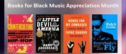
National Geographic Visual Atlas of the World, 2nd Edition

Fully Revised and Updated

Hardcover
$115.00 US
On sale Sep 19, 2017 | 416 Pages | 978-1-4262-1838-5
Uniting National Geographic's incomparable photography with state-of-the-art cartographic technology, this re-imagined and completely updated visual atlas is a compelling and authoritative resource that will enthrall readers. 

     Updated for the first time since 2008, National Geographic's visual atlas of the world will delight and inspire history lovers, current event buffs, and cartography fans alike. From spectacular space imagery to UNESCO World Heritage Sites, this stunning book showcases the diverse natural and cultural treasures of the world in glorious color. Featuring more than 200 fascinating maps, 350 new photos, and state-of-the-art cartography and satellite imagery, this is an essential reference for families, travelers, students, librarians, and scholars. Each page, created in collaboration with the world's premier scientists, geographers, and cartographers, is packed with up-to-the-minute information, making this book the most beautiful and authoritative visual atlas available today.
NATIONAL GEOGRAPHIC cartographers bring a century of mapmaking experience and cutting-edge technology to bear on every atlas product. Over the last decade, techniques used in digital mapping have undergone remarkable changes. Today, satellite and digital imaging technologies provide cartographers with new tools to map and animate Earth and our solar system. Leveraging these emerging technologies to build smart, well-designed, functional, informative atlases is one of the great strengths of National Geographic.

About

Uniting National Geographic's incomparable photography with state-of-the-art cartographic technology, this re-imagined and completely updated visual atlas is a compelling and authoritative resource that will enthrall readers. 

     Updated for the first time since 2008, National Geographic's visual atlas of the world will delight and inspire history lovers, current event buffs, and cartography fans alike. From spectacular space imagery to UNESCO World Heritage Sites, this stunning book showcases the diverse natural and cultural treasures of the world in glorious color. Featuring more than 200 fascinating maps, 350 new photos, and state-of-the-art cartography and satellite imagery, this is an essential reference for families, travelers, students, librarians, and scholars. Each page, created in collaboration with the world's premier scientists, geographers, and cartographers, is packed with up-to-the-minute information, making this book the most beautiful and authoritative visual atlas available today.

Author

NATIONAL GEOGRAPHIC cartographers bring a century of mapmaking experience and cutting-edge technology to bear on every atlas product. Over the last decade, techniques used in digital mapping have undergone remarkable changes. Today, satellite and digital imaging technologies provide cartographers with new tools to map and animate Earth and our solar system. Leveraging these emerging technologies to build smart, well-designed, functional, informative atlases is one of the great strengths of National Geographic.