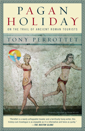
Pagan Holiday

On the Trail of Ancient Roman Tourists

The ancient Romans were responsible for many remarkable achievements—Roman numerals, straight roads—but one of their lesser-known contributions was the creation of the tourist industry. The first people in history to enjoy safe and easy travel, Romans embarked on the original Grand Tour, journeying from the lost city of Troy to the Acropolis, from the Colossus at Rhodes to Egypt, for the obligatory Nile cruise to the very edge of the empire. And, as Tony Perrottet discovers, the popularity of this route has only increased with time.

Intrigued by the possibility of re-creating the tour, Perrottet, accompanied by his pregnant girlfriend, sets off to discover life as an ancient Roman. The result is this lively blend of fascinating historical anecdotes and hilarious personal encounters, interspersed with irreverent and often eerily prescient quotes from the ancients—a vivid portrait of the Roman Empire in all its complexity and wonder.
Jupiter's Panorama
 
IT MUST HAVE BEEN LIKE a film premiere at Cannes. Throngs of excited spectators filed their way into the heart of Rome, shamelessly ogling the latest fashions and pointing out the celebrities in their midst. An impatient crowd was soon milling outside the venue—an elegant, column-lined arcade called the Vipsania Colonnade, expressly built as a sort of open-air art gallery—where a sensational new opus was about to be unveiled. White-robed priests were busy sacrificing animals to guarantee the ongoing favor of the gods. Choruses of youths sang patriotic anthems. Silver fountains burbled in nearby gardens, while food vendors and beggars noisily worked the crowd. At last, this colorful audience of ancient Romans—everyone from perfumed aristocrats in their silk gowns and brilliant togas to impoverished slum dwellers in their grimy tunics—-jostled to the foreground, all trying to have their observations heard above the cacophony.
 
Looming above them was a dazzling spectacle—a map of the world as large as a drive-in movie screen, showing the three known continents, Europe, Africa, and Asia.
 
Two thousand years later, it's easy to imagine the frisson of that heady scene—especially if you happen to be, as I was, piecing it together in the fabulous halls of the New York Public Library in midtown Manhattan, a modern-day Roman temple whose interior gleams with marble and ceilings swarm with depictions of the pagan gods. I'd fled there to escape the first heat wave of summer—steam was rising from the sidewalks like the fumes from Hades—and besides, New York reality was starting to close in on me, in more ways than one. But in that silent refuge, surrounded by piles of musty, leather-bound volumes, I found myself easily transported back to that moment in Imperial Rome, circa 5 B.C., when the world's horizons suddenly opened.
 
Few ancient citizens had even seen a street map before that day, let alone a chart of such divine ambition. The image would have been as futuristic then as the first satellite photos from NASA.
 
Exhaustive research for the map had been orchestrated by a man named Marcus Agrippa—a Roman war hero who must qualify as one of the great anal retentives of history. In order to measure the world's dimensions, Agrippa had summoned the leading scientists to Rome and provided them with archives full of field coordinates accumulated by the Imperial Army. An elite corps of land surveyors was dispatched to plot every uncharted corner of Rome's domain; in addition, the captain of every ship was required to file charts of the coastlines he had navigated. This new geographical database was then applied to the accepted mythological model of the earth. (Ancient geographers knew the world was round, but believed that terra firma occupied only the northern hemisphere, and was surrounded by the uncrossable river Ocean.)
 
The result was, not surprisingly, a map of unprecedented accuracy.
 
The emperor Augustus was presented with a miniature version for his palace; it was engraved in solid gold, with the provincial capitals marked by precious gems. But it was the monolithic image erected in the public colonnade that was the true triumph of Roman ingenuity. Sadly, not a single scrap has survived, although the tantalizing remarks of Latin authors allow us to speculate that it stretched sixty feet along the arcade and rose to thirty feet in height. The details may have been applied in pigment, but quite possibly it was one of the fabulous “paintings in stone” then fashionable in Rome—an interlocking pattern of polished marble, amethyst, and alabaster, with each piece carved in topographical relief by Greek craftsmen.
 
To the crowd gathered in the colonnade that day, nothing could have been more enlightening.
 
For a start, Romans discovered that the land masses of the earth together formed an oval shape. The three continents, Europe, Africa, and Asia, all clustered around the Mediterranean—which was then a Latin lake, identified simply as Mare Nostrum (our sea). In fact, Roman hearts must have swelled with pride to see the sheer size of Caesar's domain: The imperial eagles flew all the way from the Pillars of Hercules (Gibraltar) to the seven mouths of the Nile.
 
Rome had been chosen by the gods to rule over all of creation. One glance at Agrippa's Map (as it was known) proved that the task was largely complete.
 
Despite its distortions—remote lands like India were drawn largely from hearsay, while the frontiers were roamed by legendary Amazons, Troglodytes, and Lice-Eaters—the Map marked a revolution in the Western perception of the world. Carved onto that sprawling stone canvas was every known river, every mountain range, every port, and every city (one Roman pedant consulting it in A.D. 70 was even able to identify an obscure provincial outpost named Charax, a mile and a quarter from the Persian Gulf). But what made the image strikingly modern— and truly compelling for that Roman audience—was its practical application. The Empire's glorious highway system—Rome's pride and joy—was chiseled across its surface, the routes spreading like hardened arteries to the farthest corners of civilization. Major sea lanes could be identified, crisscrossing the Mediterranean blue. And just for good measure, the showboating general Agrippa had written a geographical commentary to accompany his masterwork, with the entire voluminous text inscribed on marble tablets along the nearby walls of the arcade. A library of facts and figures was now placed at citizens' disposal—handy data like the lengths of important rivers (Danube: 560 Roman miles), the physical dimensions of provinces (Illyria: 325 by 530 miles), circumferences of prominent islands (Sicily: 618 miles), and the distances between cities.
 
For the first time in history, a population had the world laid out before it like a buffet. Not only could viewers locate a famous site—the Colossus of Rhodes, say, or the ruins of Troy—but they could determine its exact distance from Rome and the best travel route to reach it.
 
And with every inch of the route under Caesar's protection, the Map's message was clear: The world was the Romans' oyster. Plan your holiday now.
 
The first age of tourism had begun.
 
ROMANS ON THE ROAD
 
Ensconced in the library, with a mountain of arcane texts piling around me, I delved more deeply into the ancient travel bug. And in fact, for centuries after Agrippa's Map was unveiled, legions of Romans were inspired to follow its exotic allure. The most surprising thing was how familiar their journeys were: As their memoirs, plays, and letters home revealed, these trailblazing sightseers sought out many of the same attrac tions, enjoyed many of the same pleasures—and suffered many of the same indignities—as modern travelers do today.
 
Across the entire Mediterranean world, an elaborate tourist infrastructure, anticipating our contemporary version, emerged to cater to the Romans' distinctive needs. They stayed at roadside inns, complained about hard mattresses and bad service, ate at dubious restaurants, got drunk in smoke-filled taverns, and wrote poems about their hangovers. The ancient sightseers visited lavish temples—the equivalent of our modern museums, crowded with wondrous artifacts—and handed over hefty donations to shyster priests for a glimpse of a Gorgon's hair, a Cyclops's skull, or Ulysses' sword. Just like us, they sought out celebrated historic landmarks like the Parthenon and the Pyramids. But inspiring far more enthusiasm from these ancient wanderers were the sites of mythic lore—the spot where the god Jupiter had come to earth, Venus had bewitched a mortal, or the hero Achilles had killed Hector in the Iliad.
 
The parallels became even more striking within the tourist enclaves, I discovered. Clustering around these growing tourist attractions were hordes of professional tour guides—called mystagogi (those who show sacred places to foreigners)—and it seems that the Romans were just as exasperated by their endless prattle as we are today. (“Jupiter, protect me from your guides at Olympia!” prayed a roving academic named Varro, “and you, Athena, from yours at Athens!”) The pioneering tourists bought cheesy souvenirs wherever they went, such as painted glass vials showing the Lighthouse of Alexandria or miniature statues of Apollo, and they commissioned portraits by local artists, with famous sites in the background. They pored over guidebooks written on papyrus scrolls, and even etched graffiti onto their favorite monuments. It's still there, alongside more recent efforts such as BRIG-GENERAL MAUGHAM 1820 and HARRY POTTER RULES 2001. (The erudite ancients often preferred to inscribe Homeric verse, although the most popular shorthand scrawl was the rhapsodic i WAS AMAZED.)
 
And the Romans gladly paid for a good floor show. Crowd-pleasing Egyptian priests kept crocodiles in a pond and at scheduled times fed them morsels of flesh, squirted wine into their mouths, and then hand-polished their sharp teeth. Spartans showed off their macho prowess, sorcerers conjured, oracles pronounced. In Aswan, Egypt, enterprising boatmen took tourists on rides along the Nile, rather as they do today— if the price was right.
 
As for the reviews, many of the ancient travel experiences echo down the ages—particularly one Roman traveler's comment about the locals of Alexandria: Unus illis deus Nummus est. “They worship only one god there—Cash!”
 
And just like today, the irritations of the road were forgotten on the return home. The happy voyagers would then boast about their trips at banquets, show off their art and souvenirs—and so inspire still more eager sightseers to explore a world saturated by magic and myth.
 
As for me, I had my own dark reasons to catch that ancient travel bug.
 
By the time I was on the subway back downtown that night, I was carrying a modern version of Agrippa's Map, with a thin red line scrawled from Rome to Egypt's frontier.
 
It was time to revive a great tradition.
© Haleigh Ciel
Tony Perrottet is the author of six books: Cuba Libre!, Off the Deep End, Pagan Holiday, The Naked Olympics, Napoleon's Privates, and The Sinner's Grand Tour. His travel stories have been translated into a dozen languages and widely anthologized, having been selected six times for the Best American Travel Writing series. He is a regular television guest on the History Channel and a contributing writer at Smithsonian Magazine; his work has also appeared in The New York Times, The Wall Street Journal Magazine, Condé Nast Traveler, T+L, Outside, Surface, and the London Sunday Times. He lives in New York. View titles by Tony Perrottet

About

The ancient Romans were responsible for many remarkable achievements—Roman numerals, straight roads—but one of their lesser-known contributions was the creation of the tourist industry. The first people in history to enjoy safe and easy travel, Romans embarked on the original Grand Tour, journeying from the lost city of Troy to the Acropolis, from the Colossus at Rhodes to Egypt, for the obligatory Nile cruise to the very edge of the empire. And, as Tony Perrottet discovers, the popularity of this route has only increased with time.

Intrigued by the possibility of re-creating the tour, Perrottet, accompanied by his pregnant girlfriend, sets off to discover life as an ancient Roman. The result is this lively blend of fascinating historical anecdotes and hilarious personal encounters, interspersed with irreverent and often eerily prescient quotes from the ancients—a vivid portrait of the Roman Empire in all its complexity and wonder.

Excerpt

Jupiter's Panorama
 
IT MUST HAVE BEEN LIKE a film premiere at Cannes. Throngs of excited spectators filed their way into the heart of Rome, shamelessly ogling the latest fashions and pointing out the celebrities in their midst. An impatient crowd was soon milling outside the venue—an elegant, column-lined arcade called the Vipsania Colonnade, expressly built as a sort of open-air art gallery—where a sensational new opus was about to be unveiled. White-robed priests were busy sacrificing animals to guarantee the ongoing favor of the gods. Choruses of youths sang patriotic anthems. Silver fountains burbled in nearby gardens, while food vendors and beggars noisily worked the crowd. At last, this colorful audience of ancient Romans—everyone from perfumed aristocrats in their silk gowns and brilliant togas to impoverished slum dwellers in their grimy tunics—-jostled to the foreground, all trying to have their observations heard above the cacophony.
 
Looming above them was a dazzling spectacle—a map of the world as large as a drive-in movie screen, showing the three known continents, Europe, Africa, and Asia.
 
Two thousand years later, it's easy to imagine the frisson of that heady scene—especially if you happen to be, as I was, piecing it together in the fabulous halls of the New York Public Library in midtown Manhattan, a modern-day Roman temple whose interior gleams with marble and ceilings swarm with depictions of the pagan gods. I'd fled there to escape the first heat wave of summer—steam was rising from the sidewalks like the fumes from Hades—and besides, New York reality was starting to close in on me, in more ways than one. But in that silent refuge, surrounded by piles of musty, leather-bound volumes, I found myself easily transported back to that moment in Imperial Rome, circa 5 B.C., when the world's horizons suddenly opened.
 
Few ancient citizens had even seen a street map before that day, let alone a chart of such divine ambition. The image would have been as futuristic then as the first satellite photos from NASA.
 
Exhaustive research for the map had been orchestrated by a man named Marcus Agrippa—a Roman war hero who must qualify as one of the great anal retentives of history. In order to measure the world's dimensions, Agrippa had summoned the leading scientists to Rome and provided them with archives full of field coordinates accumulated by the Imperial Army. An elite corps of land surveyors was dispatched to plot every uncharted corner of Rome's domain; in addition, the captain of every ship was required to file charts of the coastlines he had navigated. This new geographical database was then applied to the accepted mythological model of the earth. (Ancient geographers knew the world was round, but believed that terra firma occupied only the northern hemisphere, and was surrounded by the uncrossable river Ocean.)
 
The result was, not surprisingly, a map of unprecedented accuracy.
 
The emperor Augustus was presented with a miniature version for his palace; it was engraved in solid gold, with the provincial capitals marked by precious gems. But it was the monolithic image erected in the public colonnade that was the true triumph of Roman ingenuity. Sadly, not a single scrap has survived, although the tantalizing remarks of Latin authors allow us to speculate that it stretched sixty feet along the arcade and rose to thirty feet in height. The details may have been applied in pigment, but quite possibly it was one of the fabulous “paintings in stone” then fashionable in Rome—an interlocking pattern of polished marble, amethyst, and alabaster, with each piece carved in topographical relief by Greek craftsmen.
 
To the crowd gathered in the colonnade that day, nothing could have been more enlightening.
 
For a start, Romans discovered that the land masses of the earth together formed an oval shape. The three continents, Europe, Africa, and Asia, all clustered around the Mediterranean—which was then a Latin lake, identified simply as Mare Nostrum (our sea). In fact, Roman hearts must have swelled with pride to see the sheer size of Caesar's domain: The imperial eagles flew all the way from the Pillars of Hercules (Gibraltar) to the seven mouths of the Nile.
 
Rome had been chosen by the gods to rule over all of creation. One glance at Agrippa's Map (as it was known) proved that the task was largely complete.
 
Despite its distortions—remote lands like India were drawn largely from hearsay, while the frontiers were roamed by legendary Amazons, Troglodytes, and Lice-Eaters—the Map marked a revolution in the Western perception of the world. Carved onto that sprawling stone canvas was every known river, every mountain range, every port, and every city (one Roman pedant consulting it in A.D. 70 was even able to identify an obscure provincial outpost named Charax, a mile and a quarter from the Persian Gulf). But what made the image strikingly modern— and truly compelling for that Roman audience—was its practical application. The Empire's glorious highway system—Rome's pride and joy—was chiseled across its surface, the routes spreading like hardened arteries to the farthest corners of civilization. Major sea lanes could be identified, crisscrossing the Mediterranean blue. And just for good measure, the showboating general Agrippa had written a geographical commentary to accompany his masterwork, with the entire voluminous text inscribed on marble tablets along the nearby walls of the arcade. A library of facts and figures was now placed at citizens' disposal—handy data like the lengths of important rivers (Danube: 560 Roman miles), the physical dimensions of provinces (Illyria: 325 by 530 miles), circumferences of prominent islands (Sicily: 618 miles), and the distances between cities.
 
For the first time in history, a population had the world laid out before it like a buffet. Not only could viewers locate a famous site—the Colossus of Rhodes, say, or the ruins of Troy—but they could determine its exact distance from Rome and the best travel route to reach it.
 
And with every inch of the route under Caesar's protection, the Map's message was clear: The world was the Romans' oyster. Plan your holiday now.
 
The first age of tourism had begun.
 
ROMANS ON THE ROAD
 
Ensconced in the library, with a mountain of arcane texts piling around me, I delved more deeply into the ancient travel bug. And in fact, for centuries after Agrippa's Map was unveiled, legions of Romans were inspired to follow its exotic allure. The most surprising thing was how familiar their journeys were: As their memoirs, plays, and letters home revealed, these trailblazing sightseers sought out many of the same attrac tions, enjoyed many of the same pleasures—and suffered many of the same indignities—as modern travelers do today.
 
Across the entire Mediterranean world, an elaborate tourist infrastructure, anticipating our contemporary version, emerged to cater to the Romans' distinctive needs. They stayed at roadside inns, complained about hard mattresses and bad service, ate at dubious restaurants, got drunk in smoke-filled taverns, and wrote poems about their hangovers. The ancient sightseers visited lavish temples—the equivalent of our modern museums, crowded with wondrous artifacts—and handed over hefty donations to shyster priests for a glimpse of a Gorgon's hair, a Cyclops's skull, or Ulysses' sword. Just like us, they sought out celebrated historic landmarks like the Parthenon and the Pyramids. But inspiring far more enthusiasm from these ancient wanderers were the sites of mythic lore—the spot where the god Jupiter had come to earth, Venus had bewitched a mortal, or the hero Achilles had killed Hector in the Iliad.
 
The parallels became even more striking within the tourist enclaves, I discovered. Clustering around these growing tourist attractions were hordes of professional tour guides—called mystagogi (those who show sacred places to foreigners)—and it seems that the Romans were just as exasperated by their endless prattle as we are today. (“Jupiter, protect me from your guides at Olympia!” prayed a roving academic named Varro, “and you, Athena, from yours at Athens!”) The pioneering tourists bought cheesy souvenirs wherever they went, such as painted glass vials showing the Lighthouse of Alexandria or miniature statues of Apollo, and they commissioned portraits by local artists, with famous sites in the background. They pored over guidebooks written on papyrus scrolls, and even etched graffiti onto their favorite monuments. It's still there, alongside more recent efforts such as BRIG-GENERAL MAUGHAM 1820 and HARRY POTTER RULES 2001. (The erudite ancients often preferred to inscribe Homeric verse, although the most popular shorthand scrawl was the rhapsodic i WAS AMAZED.)
 
And the Romans gladly paid for a good floor show. Crowd-pleasing Egyptian priests kept crocodiles in a pond and at scheduled times fed them morsels of flesh, squirted wine into their mouths, and then hand-polished their sharp teeth. Spartans showed off their macho prowess, sorcerers conjured, oracles pronounced. In Aswan, Egypt, enterprising boatmen took tourists on rides along the Nile, rather as they do today— if the price was right.
 
As for the reviews, many of the ancient travel experiences echo down the ages—particularly one Roman traveler's comment about the locals of Alexandria: Unus illis deus Nummus est. “They worship only one god there—Cash!”
 
And just like today, the irritations of the road were forgotten on the return home. The happy voyagers would then boast about their trips at banquets, show off their art and souvenirs—and so inspire still more eager sightseers to explore a world saturated by magic and myth.
 
As for me, I had my own dark reasons to catch that ancient travel bug.
 
By the time I was on the subway back downtown that night, I was carrying a modern version of Agrippa's Map, with a thin red line scrawled from Rome to Egypt's frontier.
 
It was time to revive a great tradition.

Author

© Haleigh Ciel
Tony Perrottet is the author of six books: Cuba Libre!, Off the Deep End, Pagan Holiday, The Naked Olympics, Napoleon's Privates, and The Sinner's Grand Tour. His travel stories have been translated into a dozen languages and widely anthologized, having been selected six times for the Best American Travel Writing series. He is a regular television guest on the History Channel and a contributing writer at Smithsonian Magazine; his work has also appeared in The New York Times, The Wall Street Journal Magazine, Condé Nast Traveler, T+L, Outside, Surface, and the London Sunday Times. He lives in New York. View titles by Tony Perrottet

Celebrating 100 years of James Baldwin

In celebration of James Baldwin, the literary legend and civil rights champion, and the centennial of his birth, we are sharing a collection of his work.   James Baldwin (1924–1987) was a novelist, essayist, playwright, poet, and social critic. His first novel, Go Tell It on the Mountain, appeared in 1953 to excellent reviews, and his essay collections Notes

Read more

The New York Times’s 100 Best Books of the 21st Century

The New York Times recently published their list “100 Best Books of the 21st Century.” We are pleased to announce that there are 49 titles published from Penguin Random House and its distribution clients included in this list. Browse our collection of Penguin Random House titles here. Browse the full list from The New York

Read more